| enter keyword to search: |
|
Images db
|
|
|
Articles db
|
|
|
|
|
|
|
|
|
The mountain landscapes of Andes region: La Sierra
The Cordillera de los Andes, the Andean highland region, runs through the country north to south, dividing the coastal region from the jungle. This is La Sierra: high plateaus mountain pastures, sharply in contrast with deep canyons and snow-capped peaks. This eco region contains large plains or altiplano, called puna, where the quecha culture has developed, in the southern mountains lies Cusco the capital of the old Inca empire and the beautiful Valle Sagrado, the Sacred Valley, with the mysterious lost Inca city Machu Picchu. Deeper south due to tectonic instability, there are some active volcanoes like El Misti (5,822 m) near the beautiful white city of Arequipa and the deep Colca canyon.
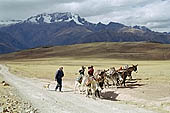
The Peruvian Puna eco region is a montane grassland found in the Andes above the limit of closed-canopy continuous forest and below the permanent snow line, approximately at 3500 m elevation. The landscape is characteristically mountainous, with a complex topography where the Andean magnificent mountains divide into a series of ridges with a large high plateau in between called the Altiplano.
Andean puna |
|
The puna is one of the most heavily altered natural regions in Peru. The long history of human settlement goes back some 10,000 years. During the Inca Empire terracing and irrigation were widely used below 4000 m, thus dramatically changing the landscape. The natural vegetation has been severely affected by grazing, burning, firewood collection and clearance for cultivation. Predominant vegetation is grassland that is burnt regularly to renew forage for grazing llamas and alpacas at the highest elevations, and cattle, horses, sheep at lower elevations.
Agriculture is found at the lower elevations used for growing potatoes and cereals. The long experience of the Andean people in selecting and maintaining crops is the basis for their rich agricultural heritage. In addition, the puna is a genetic storehouse due to the presence of wild relatives of present-day commercial crops.
The scarcity of fuel wood causes high pressure on the native vegetation. Reforestation programmes have relied heavily on introduced species, mainly eucalypts (Eucalyptus), which has probably also adversely affected the local fauna and flora.

|
Colca canyon |
There are areas classified as puna in Manu NP. in the historical sanctuary of Machu Picchu and the ridge level of the Colca canyon.
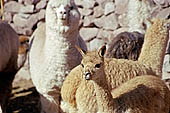
Andean llamas |
|
Andean Camelids
Typical inhabitant of the Andean puna, quintessential part of the personality of the various Andean cultures, the South American camelid has for the past 6,000 years served as a source of food, clothing and as a beast of burden for Peruvians. Over the centuries, people have crafted images of llamas, from the cave paintings to the more sophisticated Inca pottery. These animals have also formed part of countless ritual ceremonies, whether as sacrificial victims or as companions to their overlords in their tombs. Llamas are the most common and strongest and come in a variety of up to 50 colours, the strongest and appreciated as a pack animal. Called pacocha in Quechua, the alpaca has a small and more curved silhouette; it comes in a wide range of hues. In general, alpacas have more and better-quality fibre than llamas, Vicuña (Wik'uña) the smallest features a graceful body, and its fibre has been classified as the finest animal fibre on Earth, and for a time was in danger of extinction. Finally, the guanaco (Wanaku) is the wildest of the Andean camelids; the animal is not given much economical importance and lives wild.
|
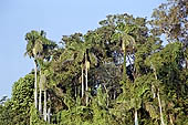
The rainforest |
La Selva, the rainforest region of the Amazon basin
The densely forested eastern slopes of the Andes downwards into the vast tropical plain of the mighty Amazon river basin which extends further into Brazil, the Peruvian Selva is still unspoiled and has some of the best untouched rain forests anywhere in the world.
The Amazon River finds its roots in Peru, the Urubamba River, an important source of the Amazon, flows northwards passing on its way magnificent sites like Machu Picchu. The river Madre de Dios rises in Peru's southern Andes and flows eastwards and eventually joins the Amazon in Brazil. Recently the source of the Amazon River has been identified on a slope of Nevado Mismi, a 5,597 m mountain in southern Peru in the department Arequipa, about 10 km from the small city of Chivay in the Colca canyon. The source of the Amazon can be defined as the furthest point from which water could possibly flow into the ocean.
There are two separate and distinct types of jungle, the Cloud forest (the montaña) the area between the eastern foothills of the Andes and the enormous rain forests of the Amazon basin.
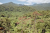
The cloud forest |
|
The cloud forest
At an altitude between 1,800 m to 2,500 m, between the Andes and the Amazon basin lies the world of the tropical cloud forests. It is a unique hemisphere on its own. The cloud forests grow and they are named for their intense humidity, Most of the time the cloud forests are indeed covered in clouds. The warm and rainy climate produce a lush and diverse flora, a rich profusion of trees, plants, and jungle vines, including mahogany, cedar, rubber, and cinchona trees, with arboreal ferns, bromeliads orchids and a variety of exotic tropical flowers. This is the region of coca cultivation together with the other subtropical products like coffee, tea, cocoa, etc. The ancient city of Machu Picchu is located in this environment.

|
The cloud forest |
The Jungle
Also known as the Amazon plain, this region, the largest and least inhabited in the country, is made up of lush tropical vegetation and a vast network of rivers. The perceived fertility of the Amazon, especially in comparison to the harshness of the altiplano, seems a godsend. However, the jungle soil is actually of poor quality and has very few nutrients. It is not at all well suited to agriculture, and once trees have been cut down, rain washes away the fertile topsoil and the soil quickly becomes useless and agriculture impossible.
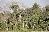
Manu NP |
|
The inaccessibility of most of the jungle means that most of it is still intact and in many cases virgin. One of the best-preserved areas of rainforest in the world is the Manu National Park, an extension of almost two million hectares, between Cusco and Madre de Dios River, with very little human settlements.
|
Related Pages
-
-
-
-
-
-
-
-
|
|
|
 |
|
|


